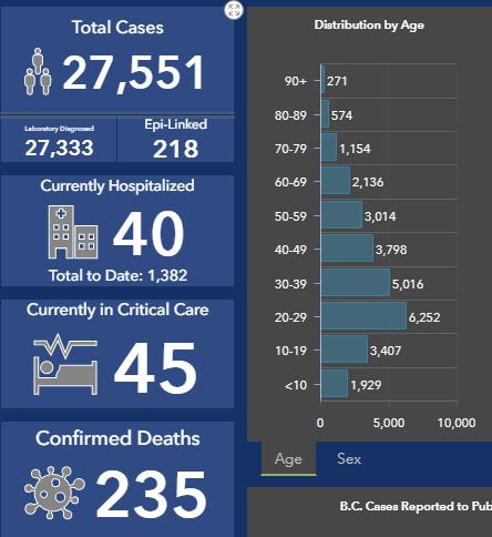
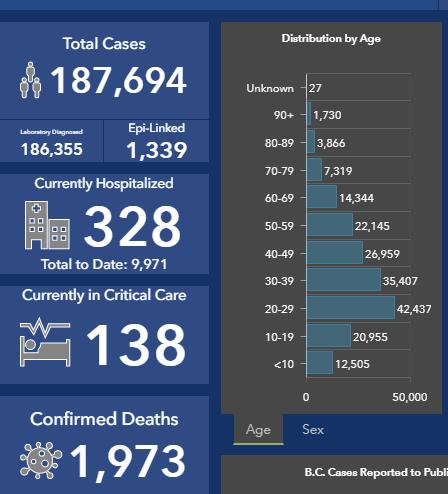
Both graphs above – current from the BC Centre for Disease Control
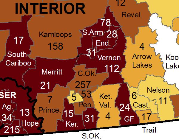
Below – case maps for our area – reporting period September 19-25
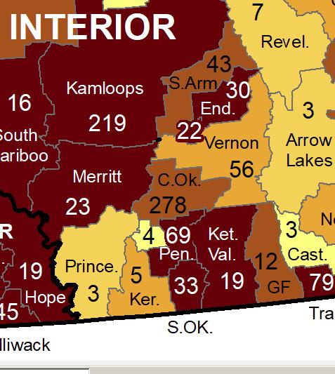
Compared to
Below – case maps for our area – reporting period September 12-18
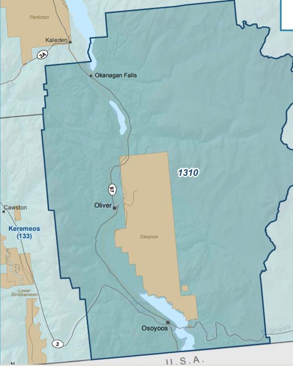
Below – first time it has been clarified as to what is included in figure from South Okanagan – OK Falls, Oliver, Willowbrook, Anarchist Mt., Osoyoos and the Osoyoos Indian band land