Location: 6 kilometres north of Osoyoos
• See approximate location of this wildfire on an See Map interactive map
• View an interactive map of all active Wildfires of Note.
Discovered: Monday, July 19, 2021
Size: 17,472.0 hectares (estimated)
Status: Active
The fire is classified as Out of Control. Learn more about stages of control: Response Types and Stages of Control
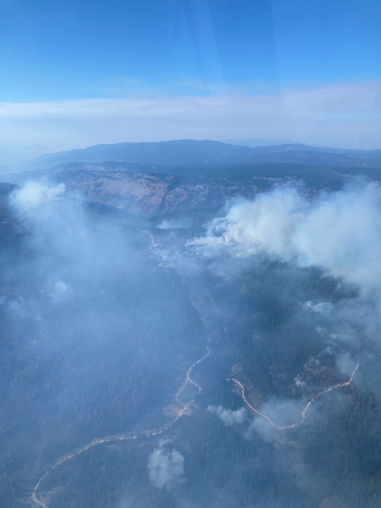
A warm, drying trend has returned to the south Okanagan. Temperatures will remain seasonal or above seasonal for several days. Relative humidity will drop as temperatures increase. Winds will continue to be from the northwest but are expected to shift to southerly flows as a frontal system passes through the area within the next few days. This front will cause fire behaviour to increase, and growth of the fire is expected. Crews and equipment are prepared for this shift in winds and increase in fire behaviour and will be ensuring that they have plans for a safe escape from the fire line should the need arise. They will also be working to complete and reinforce guard lines prior to the passing of the front.
Airtankers may be used again today to support a large contingent of crews who are working in steep, rocky terrain on the northwest flank of the fire, which saw some growth overnight and this morning. The airtankers are used to apply retardant to slow the spread of the fire, which provides more time for ground crews to construct and reinforce guard lines. Helicopters will be used to support this effort by bucketing water onto the fire unless limited visibility from smoke prevents helicopters from flying. Guard lines may be reinforced by planned ignition operations in this area today if conditions allow. This work on the northwest flank is being done to keep the fire out of the front country.
Firefirefighters continue to mop-up hot spots along the southern fire perimeter.
A mobile task force of structural protection crews and engines will continue to patrol to protect assets along McKinney Road, near Mount Baldy and in other areas of the fire. This task force will also action hotspots that are found during patrols. These engines may also be used to supply water to fire line crews where possible. Structural protection assessments were reviewed and updated in the mount Baldy area over the past 2 days.
98 Mexican firefighters continue to work within high priority areas of the fire on the south and east flanks.
A BC Wildfire Service Incident Management Team is managing the Okanagan Complex, which includes the Thomas Creek (K51794), the Brenda Creek (K51924) and the Nk’Mip Creek (K52061) wildfires. Aircraft and other resources may be reallocated from day to day within the complex as priorities shift.
Interface: Interface Interface Fire
Evacuation Order is in effect.
The BC Wildfire Service continues to re-evaluate its recommendations to The Osoyoos Indian Band, the Kootenay Boundary Regional District and the Regional District of Okanagan Similkameen regarding downgrades to evacuation alert and order areas based on current fire risk and activity. On August 8th, the BC Wildfire Service made a recommendation to the Regional District of Okanagan Similkameen to downgrade evacuation orders to alerts in the northern area of the fire
Please visit these local government websites for the most current information on evacuation orders and alerts:
Osoyoos Indian Band: www.oib.ca
Kootenay Boundary Regional District: www.emergency.rdkb.com/Current-Emergencies/nkmip-creek-fire
Regional District of Okanagan Similkameen: www.rdos.bc.ca
More information
Area Restriction Order
An Area Restriction went into effect on July 24, 2021, and updated on August 7, 2021 for the Nk’Mip Creek wildfire. See a map of the updated affected area here and the updated Area Restriction document here