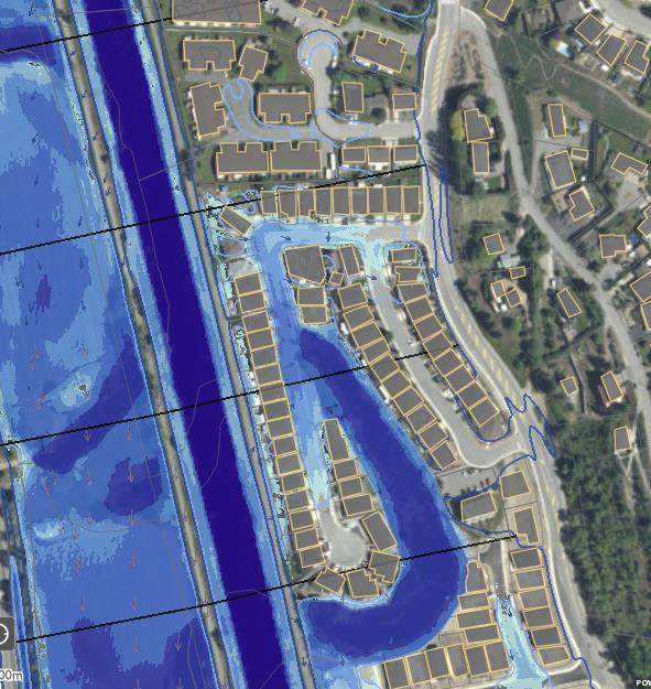
 “This website, at www.OkanaganFloodStory.ca is the culmination of two years of flood mapping in our valley. And it’s very clear that through state-of-the-art modelling that the potential for flooding is increasing with climate change. These maps are the first step in understanding and reducing our flood risk,” Anna Warwick Sears of OBWB stated.
In addition to the new flood maps, visitors to the website will find historical information on flooding in the Okanagan, how climate change is effecting flooding, as well as how residents and local government can reduce risk, prepare, respond, recover, and more.
“It’s definitely something we all need to pay attention to, as local government and as residents – we need to address this together,” added Sue McKortoff, OBWB Chair and Mayor of Osoyoos. “As we like to say at the OBWB, we are all part of ‘One valley. One water.’ What happens in one part of the valley, affects the next. And we all have a responsibility as Okanagan residents to build flood resilience.
“I know people like to live down on the water with the views, and be able to jump in their boats. But you know, there’s a reason why Osoyoos Indian Band didn’t build on the water. They knew what would happen,” McKortoff noted. “It’s too easy for people to be guided by their hearts and not their heads, until it’s too late. Having updated mapping, and concrete information that says ‘here are the best practices,’ will help residents make the right decisions, as well as local governments and even provincial and federal officials.”
Editors Note – map is of my home, the Mayor home, the MLA’s home and a lot more. Try it and see if you can make it work for you. Despite the words of the man on the TV it is not an easy interface for public information.