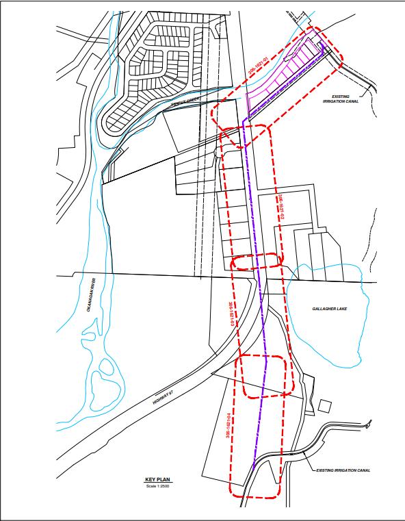
 Preliminary routing plan from June 7, 2017.
Question:
Can you give a brief update on the plan for the Gallagher Lake “pipe” – I understand the pipe will be on the west side but I did know this until recently.
[SG]
“This has always been the route from even the first preliminary drawings to be on the west side of the Highway because that is the only place that has room and less disruptive to traffic. MOTI has approved this location.”
Question:
When did the plan change as I had thought the original plan was to divert from canal – down Barisoff access road to pipe that would be dug on the east side.* corrected
[SG]
“We never considered the access road because it is private property and the route on the south side of the Klein property already had a MOTI ROW (supposed to be the real access to Barisoff Property) and we negotiated with property owner to increase the width and the extra would become a wider MOTI access road on the north side of the Parkridge trailer park.”
Question:
Do you have a picture of any new drawing (shown above that would be great – but the timing of the decision change – whenever that was – seems key to any story I might want to write? Maybe I missed this detail in briefings to council in the last bit.
[SG]
“Never has changed? We have always been looking at this route if Council decided to go with the siphon option. There were other options on the board; new intake at river by Buchannan Road was one or rerouting from west side of Hwy back over to James Way. Whether going with a 8’ siphon (gravity) or 5’ siphon w/ Low Head Pumphouse… it was basically the same route.”
Shawn Goodsell is the Operations Manager
Town of Oliver
***
From Town of Oliver website
PROJECT RATIONALE
▪ In January 2016, a large rockfall occurred at Gallagher Lake, crushing the reinforced
concrete siphon below which conveys irrigation water to agricultural properties in the
RDOS Area C. An internal repair was completed, during which time a 1.2 meter diameter
pipe was grouted in place. This repair has allowed for continued use of the canal, operating
at a 32% reduction in supply capacity.
▪ Repair and re-routing options were reviewed by the Town and Osoyoos Indian Band. The
life cycle costs for construction, operation and maintenance led to the final design
presented herein.
DESIGN OVERVIEW
▪ A large diameter pipe will connect to the concrete open channel canal north of Vaseux
Creek.
▪ Irrigation water will travel under Vaseux Creek following the same route as the existing
canal crossing.
▪ Irrigation water will flow into a pump station near the outlet of the existing canal crossing.
▪ Irrigation water will travel from the pump station through a 1.5 meter diameter pipe down
the road Right of Way north of the Country Pines Mobile Home Park.
▪ It will travel south on Highway 97 between the highway and Gallagher Lake Frontage
Road.
▪ The pipe will then cross Highway 97, travel across Osoyoos Indian Band reserve land and
reconnect to the existing open canal.