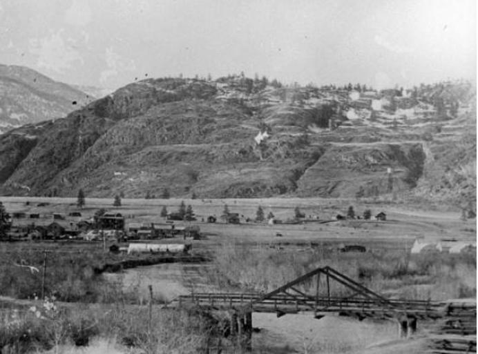
 Picture of old bridge and curvy river circa 1921 – files of Okanagan Archive Trust Society
Dedication June 15 – 1958
Oliver had a Centennial Board made up of Doug Smithers, Vic Casorso, Harold Potter, Jack White, Chris Goodman, Ed Reid, Frank McDonald, Cec Duggan, Rev. Fredrick Stanford, D.M. Smith, Ed Hack and W. Pearson.
It appears that park planning and maintenance was looked after by the local Rotary Club for many years until the village of Oliver assumed control in about 1970. At that time the train tracks were torn up on KVR south route to Osoyoos. Many will remember a mini-golf operated by the Rotary across from the IGA.
From the opening program: The site originally consisted of two small level pieces of land at the north and south ends of the Park site. The balance being river (ox-bow). The old “swimming hole at the north end and a lot of brush from end to end. A tennis court at the south end. “Carter’s crater on the east side of the bridge was a popular place for swimming. .
In 1955 the river was made into a channel creating a different Oliver. The ox-bow was filled in with water hydrants installed with more improvements in the trailer park. Project financing partly by the village and the remainder from a Provincial Centennial Grant.
Harry Carter was the Chairman of the Village Commission with a council of Bill Cranna, Cec Duggan, Hec Scott and B. Weeks.
The South Okanagan Lands Project (SOLP) and its manager Frank McDonald were big players in a small town and much of the work done by the lands project. The village office with a small staff in the old fire hall and lands project at the present Town office.
In 1984 a walking park was planned along the river from the Fairview Bridge to McAlpine Bridge north of Oliver. A hike and bike society formed to complete the job.
A personal note: I worked at the CPR station in 1963 at the age of 16 as a messenger board and came back for a second summer job in 1964 but for the life of me – I cannot remember a trailer park to the east of the station and the railway line which had daily service to Osoyoos and Penticton with a lot of trucked freight locally hauled by Bill Grant and Al White. The area was deep into the ground so trucks could haul off platforms, it rained and the water made large puddles. The location was quite industrial. My belief that most of the camping and trailers would be to the north near the present location of two old domestic water pumps.
I seek your memories in helping to paint this picture.
Thanks to the staff at the Oliver and District Heritage Society for a review of their files.