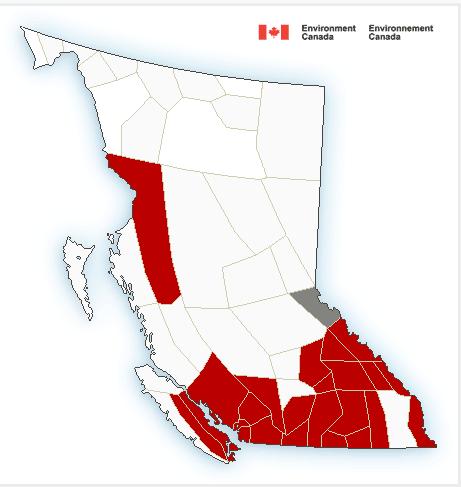
 Warnings
4:02 AM PST Wednesday 08 February 2017
Snowfall warning in effect for:
- Boundary ( Okanagan Valley – Vernon is mentioned only)
A long period of snowfall, with total amounts of 15 to 25 cm is expected.
An intense Pacific warm front will spread snow to the southern interior late today. The snow is forecast to become heavy at times tonight through Thursday.
Prepare for quickly changing and deteriorating travel conditions. Surfaces such as highways, roads, walkways and parking lots may become difficult to navigate due to accumulating snow. If visibility is reduced while driving, turn on your lights and maintain a safe following distance.
Please continue to monitor alerts and forecasts issued by Environment Canada. To report severe weather, send an email to ec.tempetepacifique-pacificstorm.ec@canada.ca or tweet reports to #BCStorm.
Local forecast:
| date | Detailed Forecast |
|---|---|
| Today | Mainly cloudy. 30 percent chance of flurries early this morning. Snow beginning this afternoon. Wind becoming northwest 20 km/h this afternoon. High minus 4. |
| Tonight | Snow. Amount 5 to 10 cm. Wind becoming south 20 km/h before morning. Temperature steady near minus 4. |
| Thu, 9 Feb | Cloudy with 60 percent chance of flurries. Wind south 20 km/h. High zero. |
| Night | Cloudy with 40 percent chance of flurries. Low plus 1. |
| Fri, 10 Feb | Cloudy. High plus 4. |
| Night | Cloudy. Low minus 3. |