 Press for larger
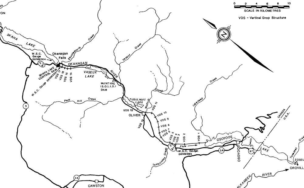
Found in source documents on the 1942 and 1948 floods – which let to the “managed flow” system on the Okanagan River Channel that opened in 1958.
Yes I did note the name “Testalinden” on the map
Press for larger
Found in source documents on the 1942 and 1948 floods – which let to the “managed flow” system on the Okanagan River Channel that opened in 1958.
Yes I did note the name “Testalinden” on the map