Special weather statement in effect for:
•Central Okanagan – including Kelowna
•North Okanagan – including Vernon
•South Okanagan – including Penticton
Freezing rain potential today and Saturday.
Bands of moisture will continue to move across the interior today through Saturday. A layer of warm air will also sweep across the coastal mountain tops and over the interior valleys giving the likelihood of above freezing temperatures aloft. Freezing rain may develop wherever sub-freezing air near the surface persists. Rain falling into sub-freezing air will freeze on contact, creating hazardous icy travelling conditions.
Freezing rain is possible first near Princeton, Merritt and through the Fraser Canyon this afternoon and then to areas as far east as Creston and as far north as Quesnel overnight. Snowfall accumulations of 5 centimetres or less are expected.
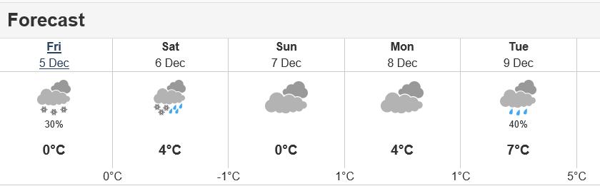
The public is advised to monitor future forecasts and warnings as warnings may be required or extended. Below is forecast for Osoyoos.